Five Days Across Austria: Vienna to Innsbruck
I left Vienna with five days to reach Innsbruck and a route that continued west. The train took me to St. Pölten, where I changed to a rental car for the drive through Lower Austria and into Tyrol. Beyond Krems, the route followed the Danube through the Wachau. Salzburg and the Salzkammergut lay farther on, followed by Alpbach and the final approach to Innsbruck through the Inn Valley.
Austria measures roughly 575 kilometres from east to west, yet this crossing gathered several landscapes into a compact route: vineyard terraces, lake country, limestone peaks and Alpine valleys. At St. Pölten, however, the journey began with collecting the keys and learning the controls of an unfamiliar car.
Changing from Rail to Road
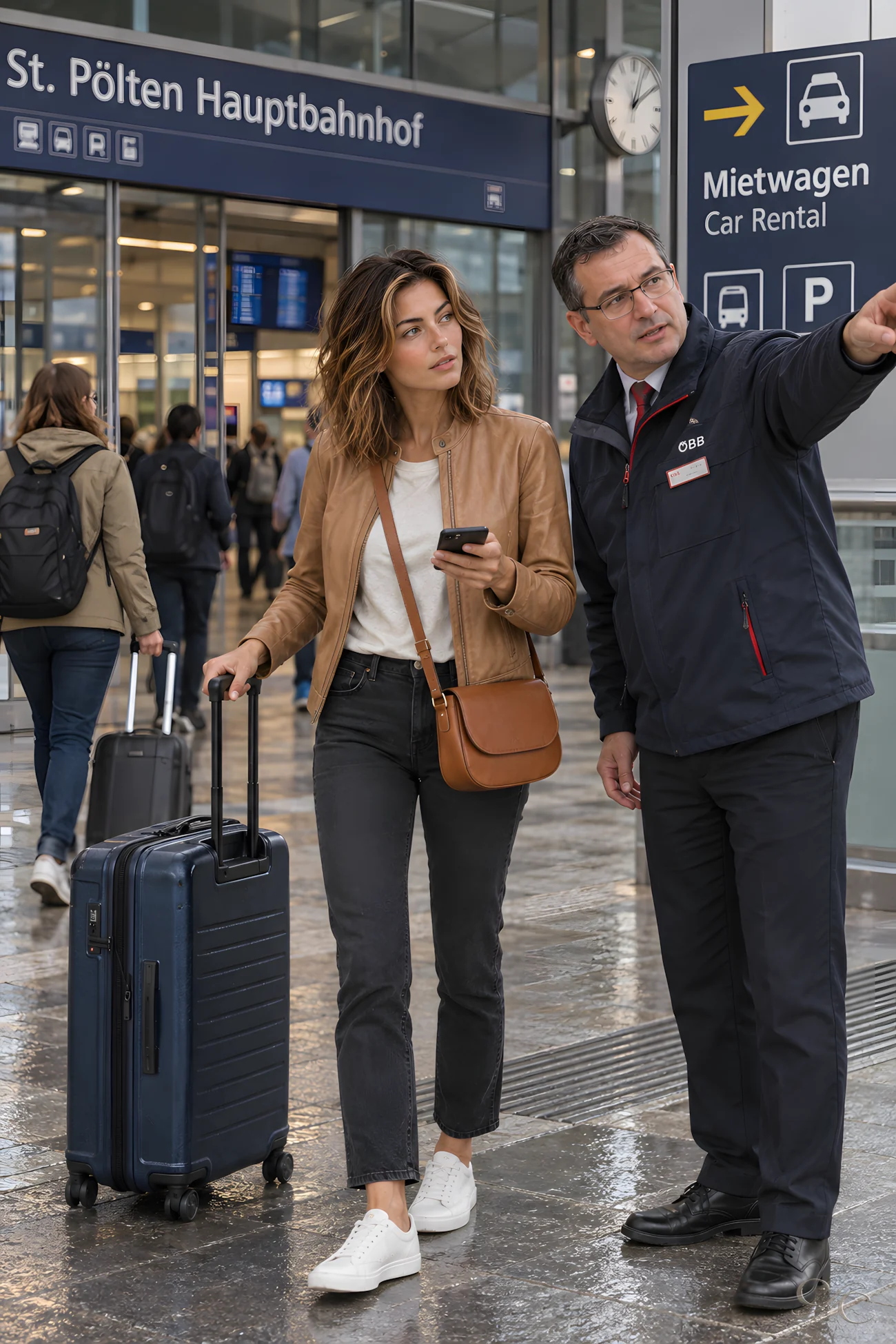
I reached St. Pölten Hauptbahnhof from Vienna around noon. The station sits on Austria’s main east–west rail corridor, but my next leg turned toward Krems by car. After collecting the keys, I entered the route into the navigation system and checked the controls. With the directions set, I pulled away from the station and began the first westward stretch on my own schedule.

A Slow Lunch in Krems
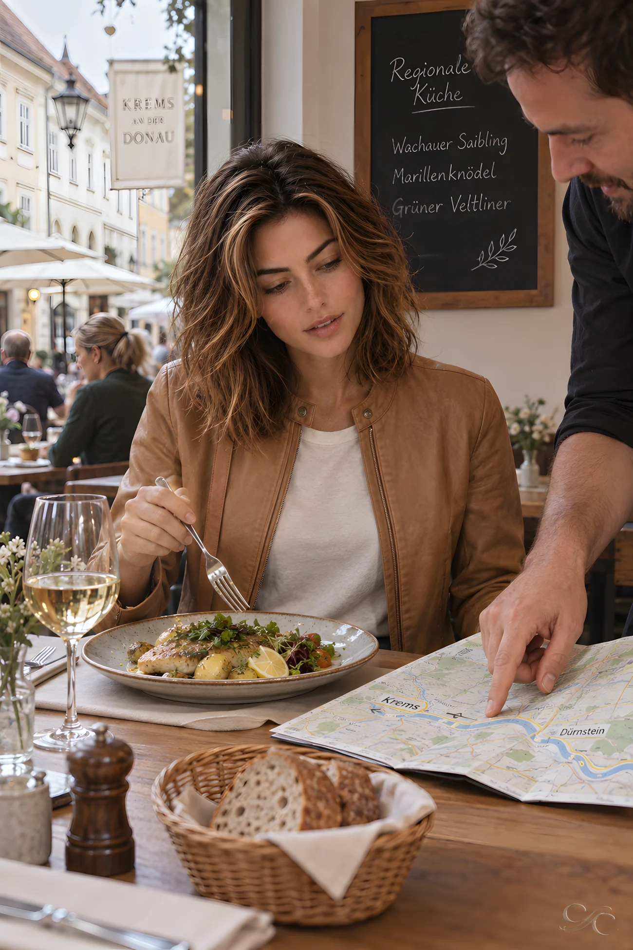
In Krems, I let lunch take longer than the road required. Over a regional meal, I checked the map instead of relying only on the navigation screen. Krems marks the eastern end of Austria’s Wachau, the UNESCO-listed Danube landscape extending west toward Melk. Dürnstein lay only about eight kilometres away on the river’s north bank. I confirmed the direction, finished lunch without hurrying and continued into the valley.
First View of the Danube
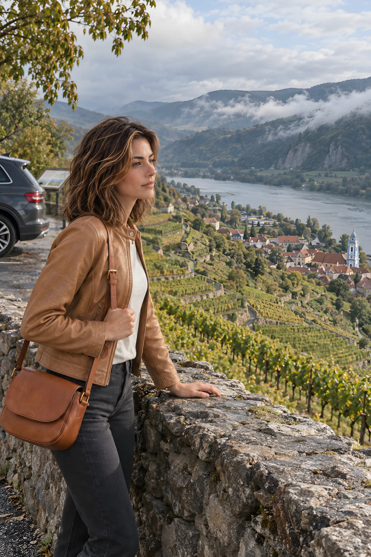
West of Krems, the road opened beside the Danube, with rain darkening the slopes and vineyard terraces rising above scattered villages. Many of the Wachau’s steep plots depend on dry-stone walls, which hold the thin soil in place and create narrow working levels for the vines. At Dürnstein, the broad river road gave way to tight historic lanes, with the cultivated hillside rising close behind the compact village.
Following the Wet Village Streets
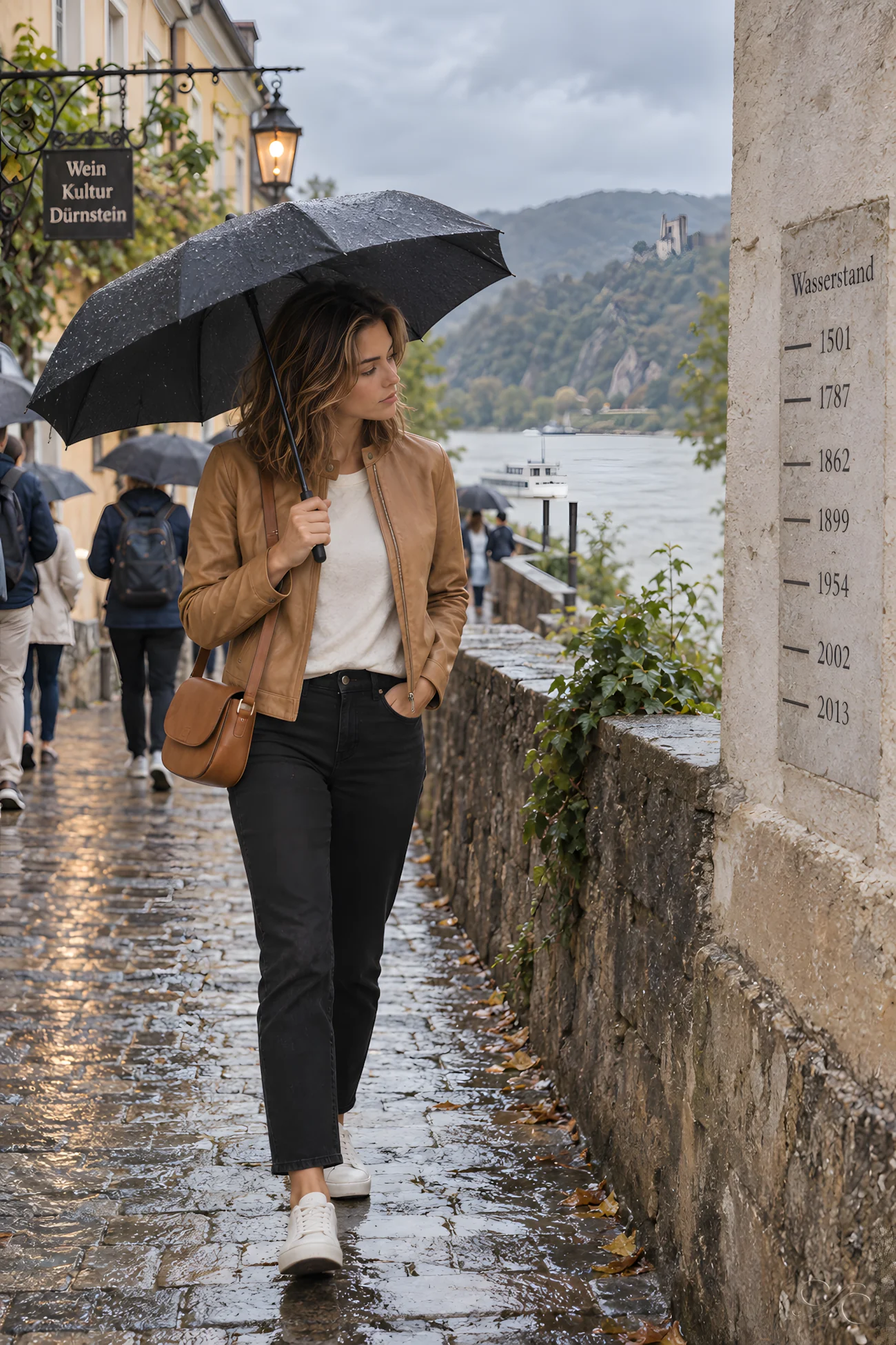
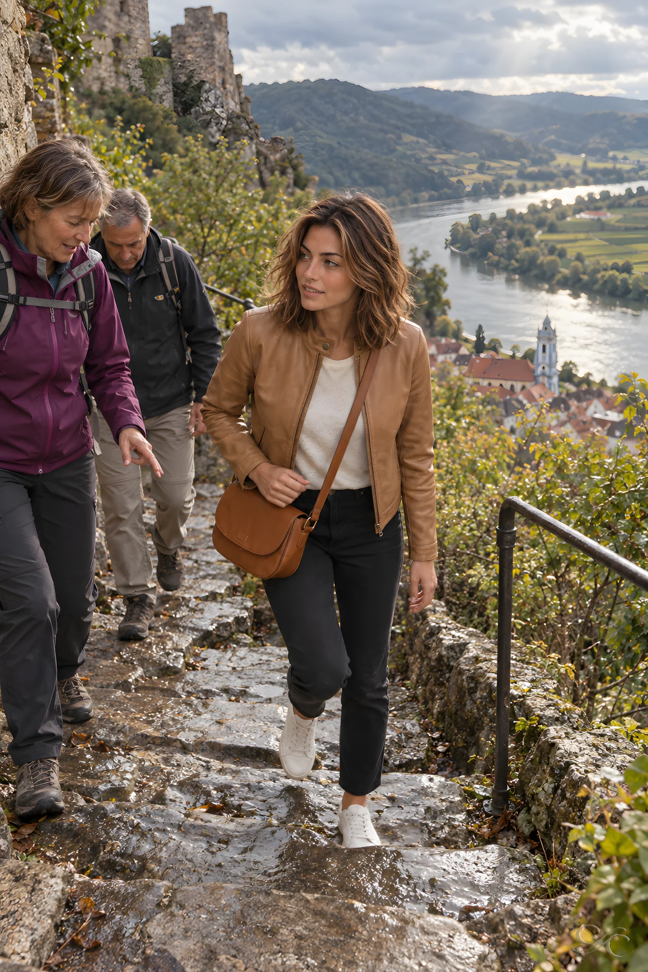
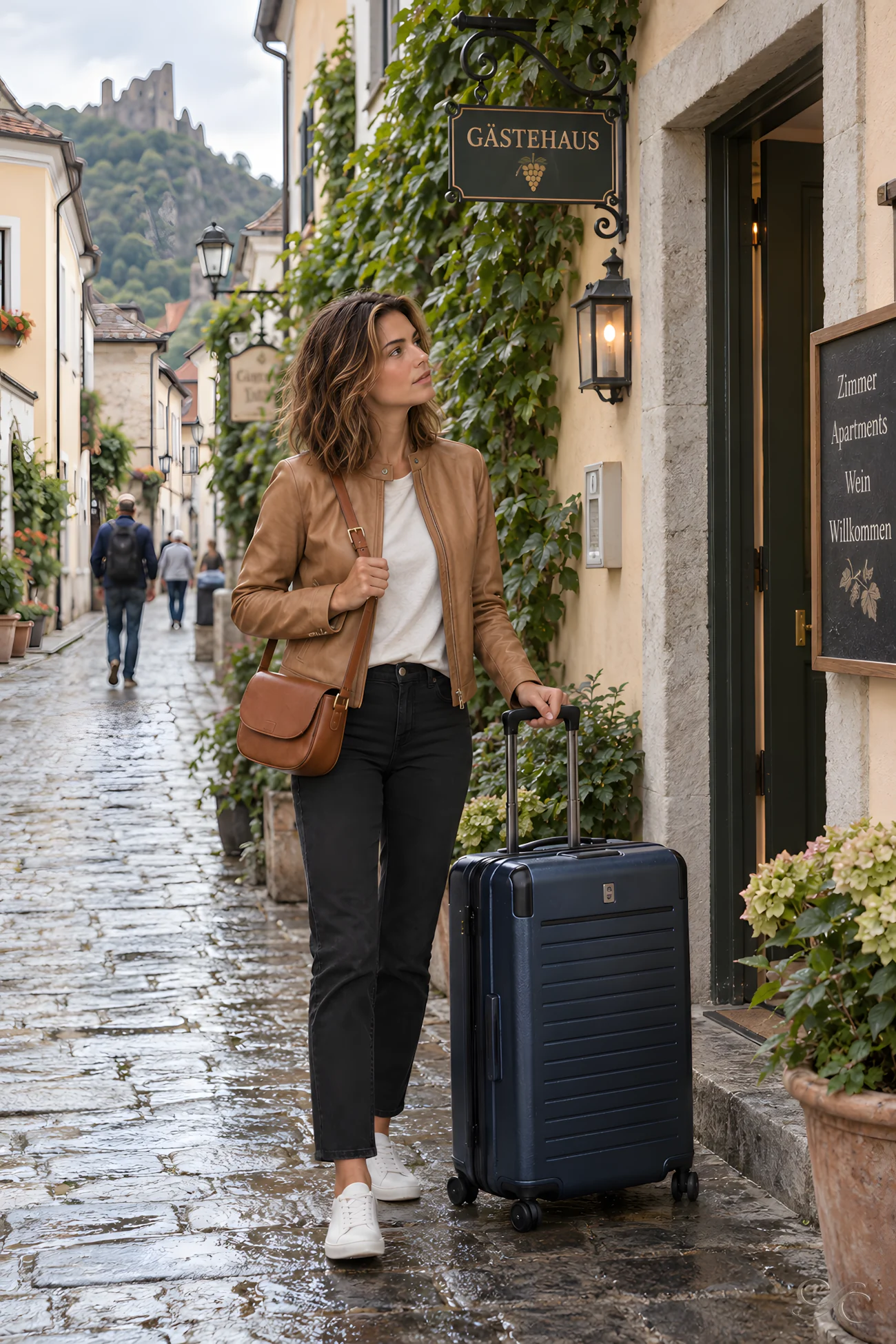
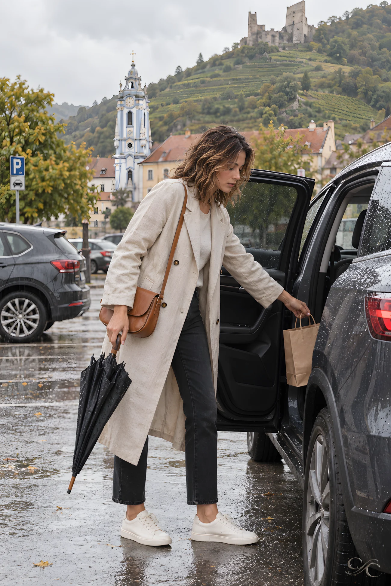
Rain darkened Dürnstein’s lanes and riverside, where a high-water marker recorded how far the Danube had once risen. Between the houses, pedestrians and local traffic shared passages barely wide enough for both. When the shower cleared, I followed the damp path toward the castle ruins. The wet stones required careful footing, but higher up, the cloud briefly lifted, opening a view across the river, vineyards and shifting light of the Danube valley.
Breakfast Over the Road Map
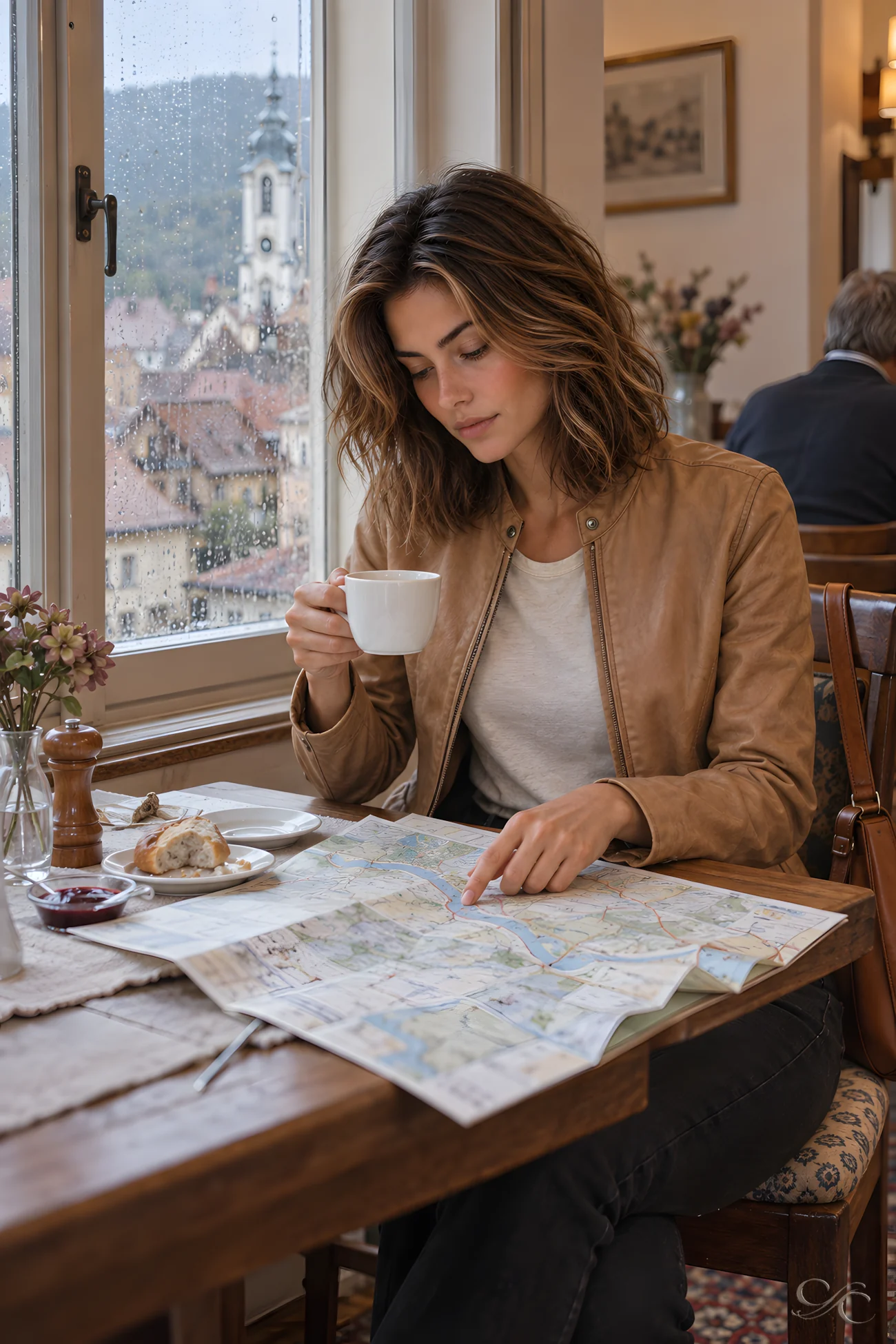
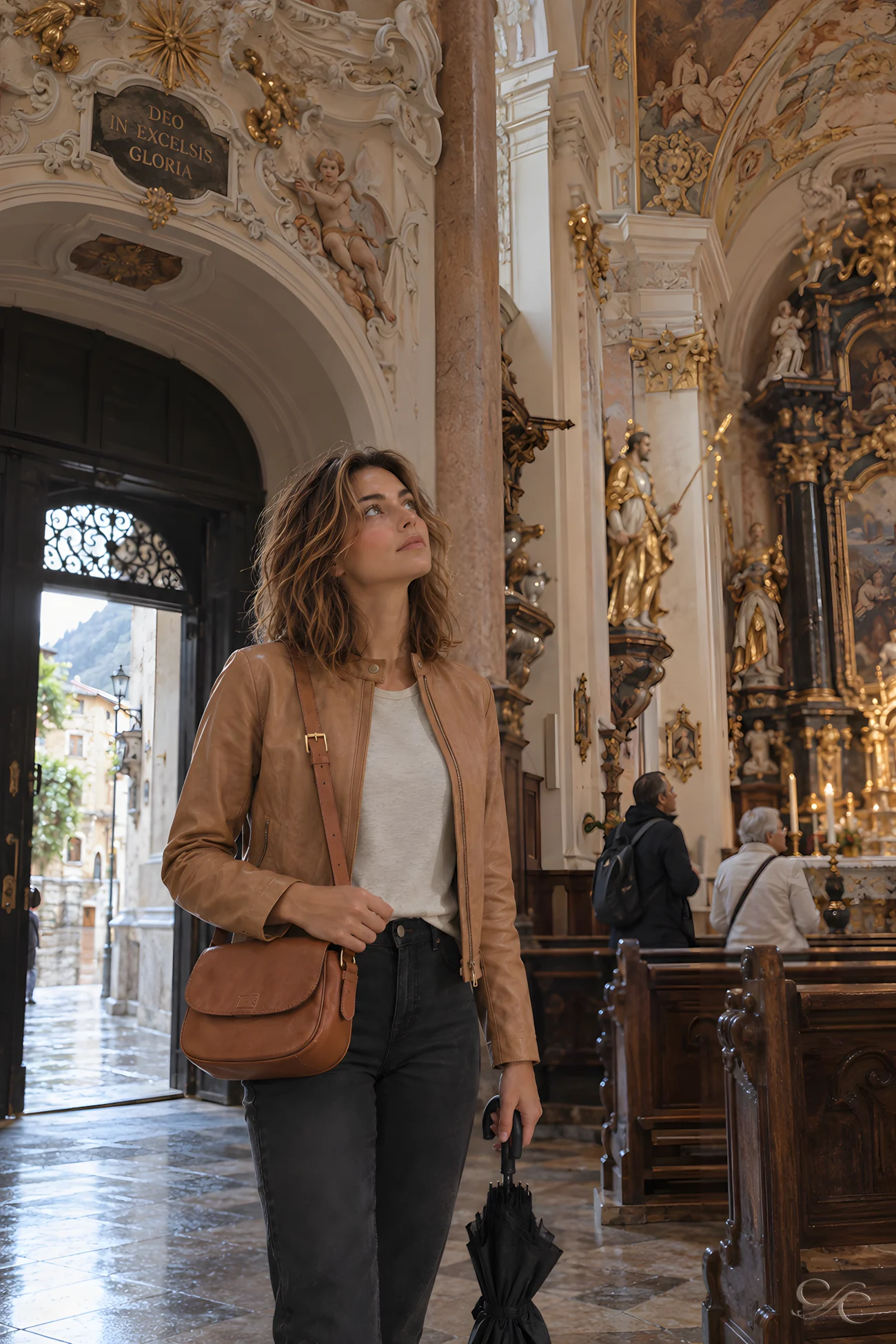

Over breakfast, I traced the road west along the Danube before taking another circuit through Dürnstein’s rain-muted lanes. Inside the abbey church, the restrained street frontage gave way to an ornate Baroque interior; its blue-and-white tower has marked the village skyline since the eighteenth century. In a small shop, the owner pointed out Wachau apricot preserve. Wachauer Marille is a protected regional name reserved for locally grown fruit. I packed a jar for the drive ahead.
Leaving Dürnstein in the Rain
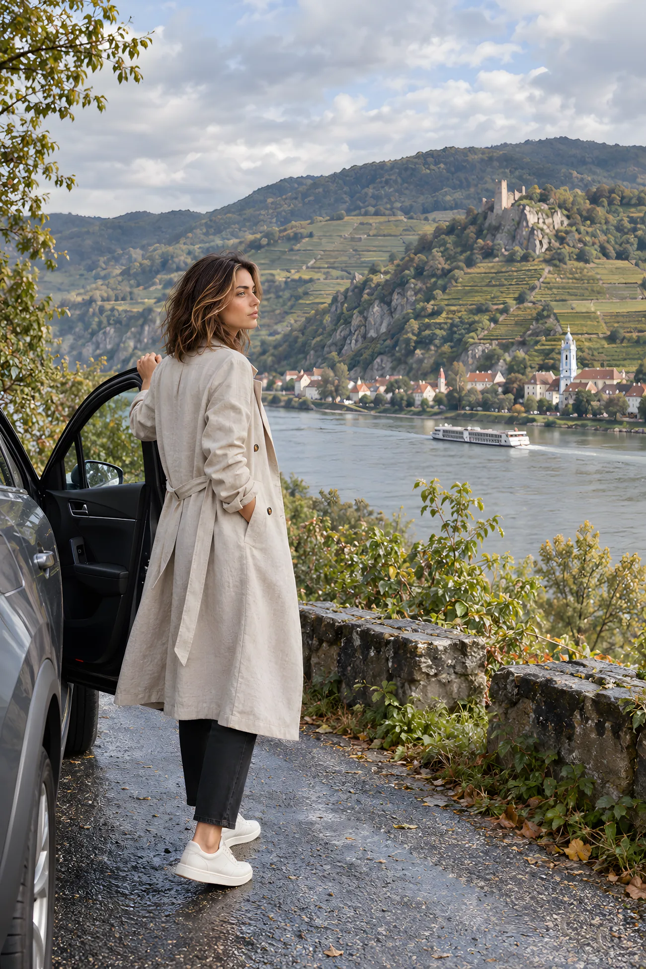
I packed the rental car while rain still blurred Dürnstein’s lanes, then followed the Danube west. The north-bank road occupied the narrow ground between the river and vineyard slopes, so the village receded in fragments. When the weather eased, I pulled over. Across the road, terraces stepped above the Danube, their retaining walls tracing the hillside, while low cloud covered the upper slopes. Dürnstein remained visible behind me through the thinning rain.
A Bakery Stop in Spitz

In Spitz, I left the damp street for the warmth of a bakery counter. After a few words with the clerk and a look over the pastries, I chose one filled with poppy seed. Mohn, a familiar ingredient in Austrian baking, is usually ground and mixed with sugar into a dark, nutty filling. The clerk wrapped it, and I returned to the car with the paper parcel.
Melk Above the Parking Meter
I stopped on a rain-darkened street in Melk, where a parking meter stood below the abbey’s immense hilltop façade. One of Austria’s great Baroque monasteries, the Benedictine complex was largely rebuilt in the early eighteenth century, its Baroque scale heightened by the town beneath it. Beyond Melk, another shower followed me west. At the next roadside pause, the close vineyard villages had fallen
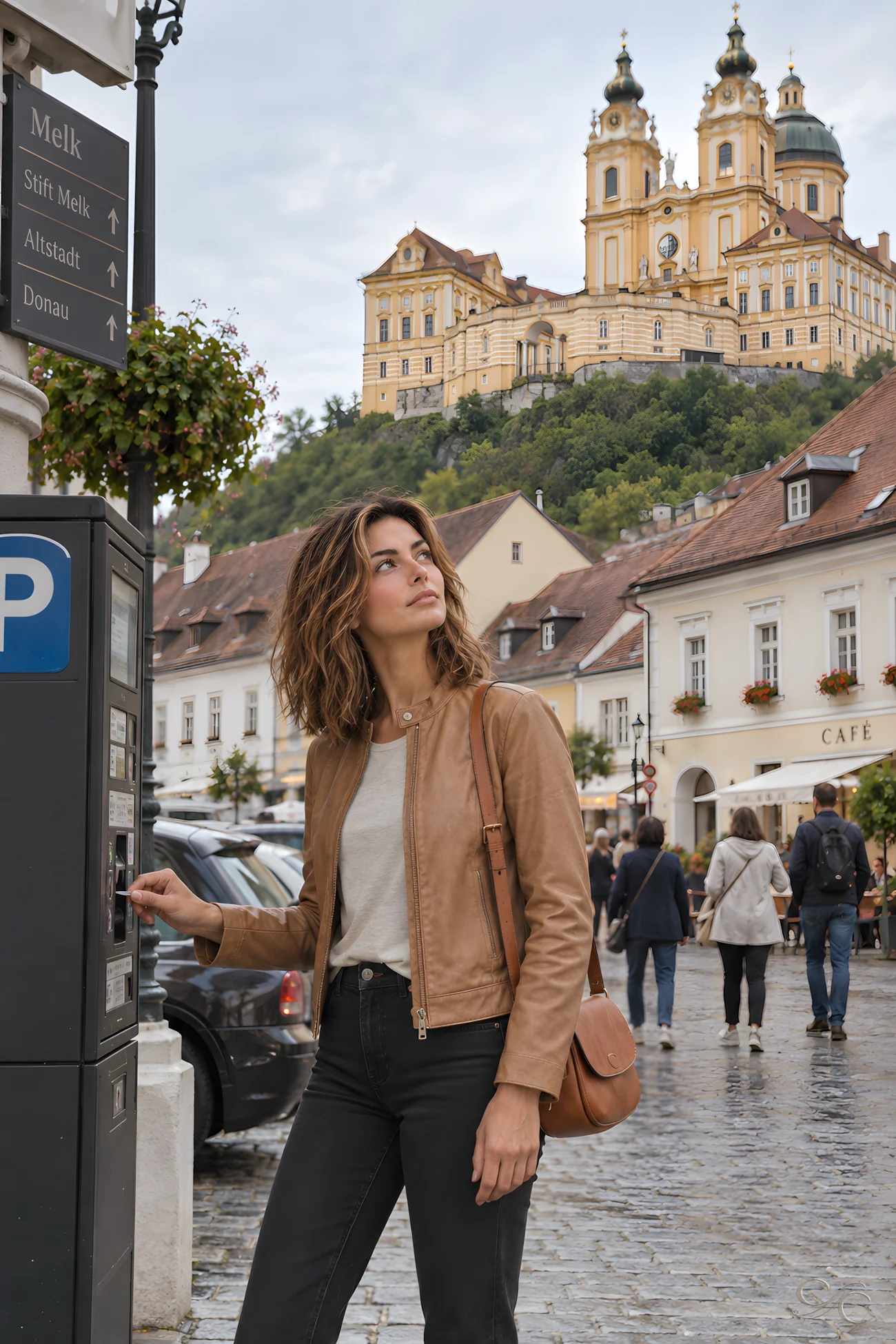

away. Broader fields opened beside the road, with low hills rising under broken cloud.
Arriving in Salzburg After the Rain

I reached Salzburg in the early evening and made an unhurried first circuit through the Altstadt. Rain still shone on the paving and historic façades; pedestrians threaded between cafés and shops as the lights came on. The historic left-bank core is compressed between the Salzach and the steep Mönchsberg and Festungsberg. Above the roofs, the surrounding hills remained dark beneath the clouded sky.
Breakfast at a Salzburg Café
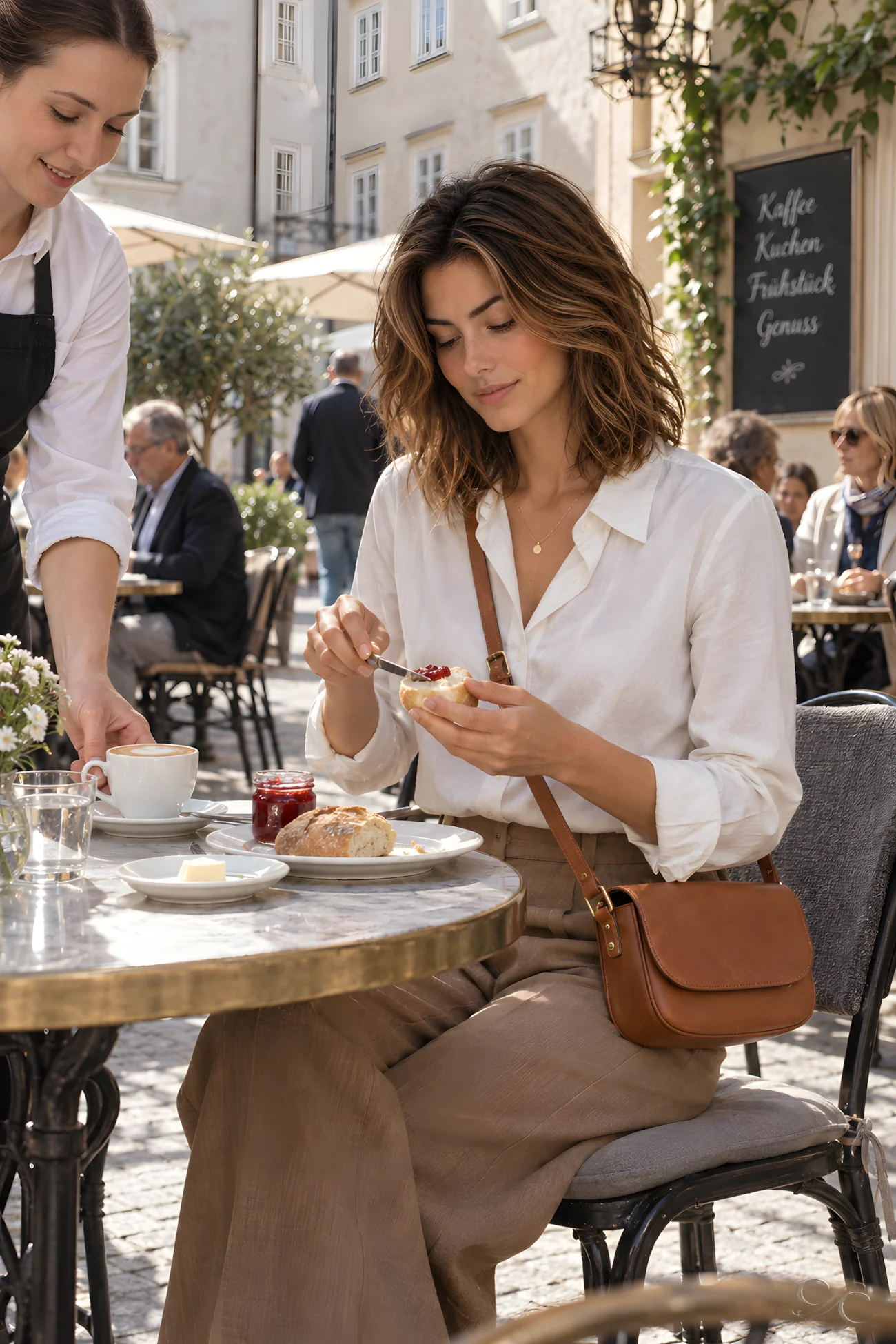
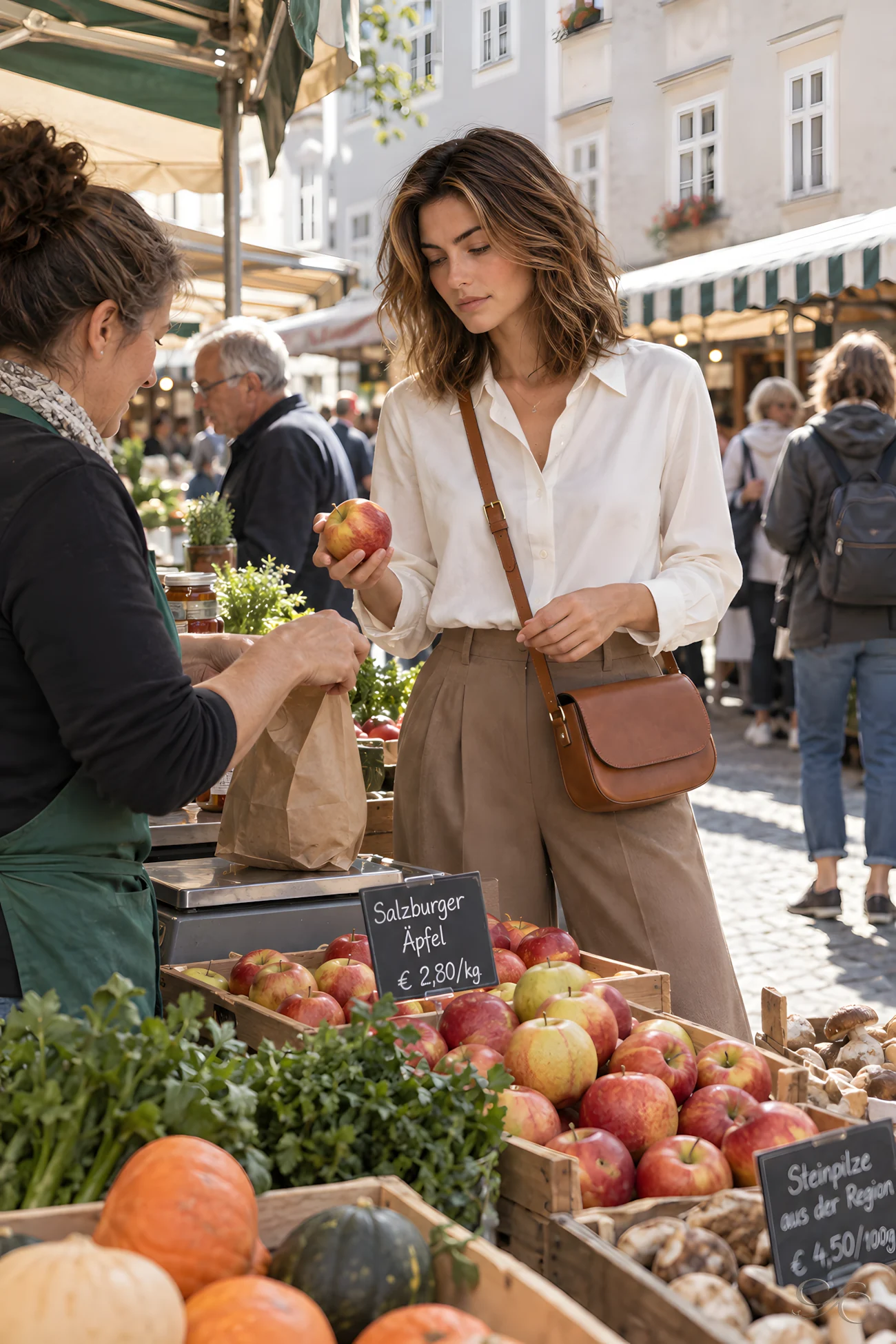
After two days of rain, I began my first dry Salzburg morning over a café breakfast, with no need to hurry from the table. In Austria’s traditional coffeehouses, a single order commonly comes with a glass of water and time to linger. Outside, I crossed the brighter streets to a compact market filled with early-autumn produce. At one stall, I chose apples, exchanged a few words with the vendor and carried them with me.
A Delivery in the Altstadt
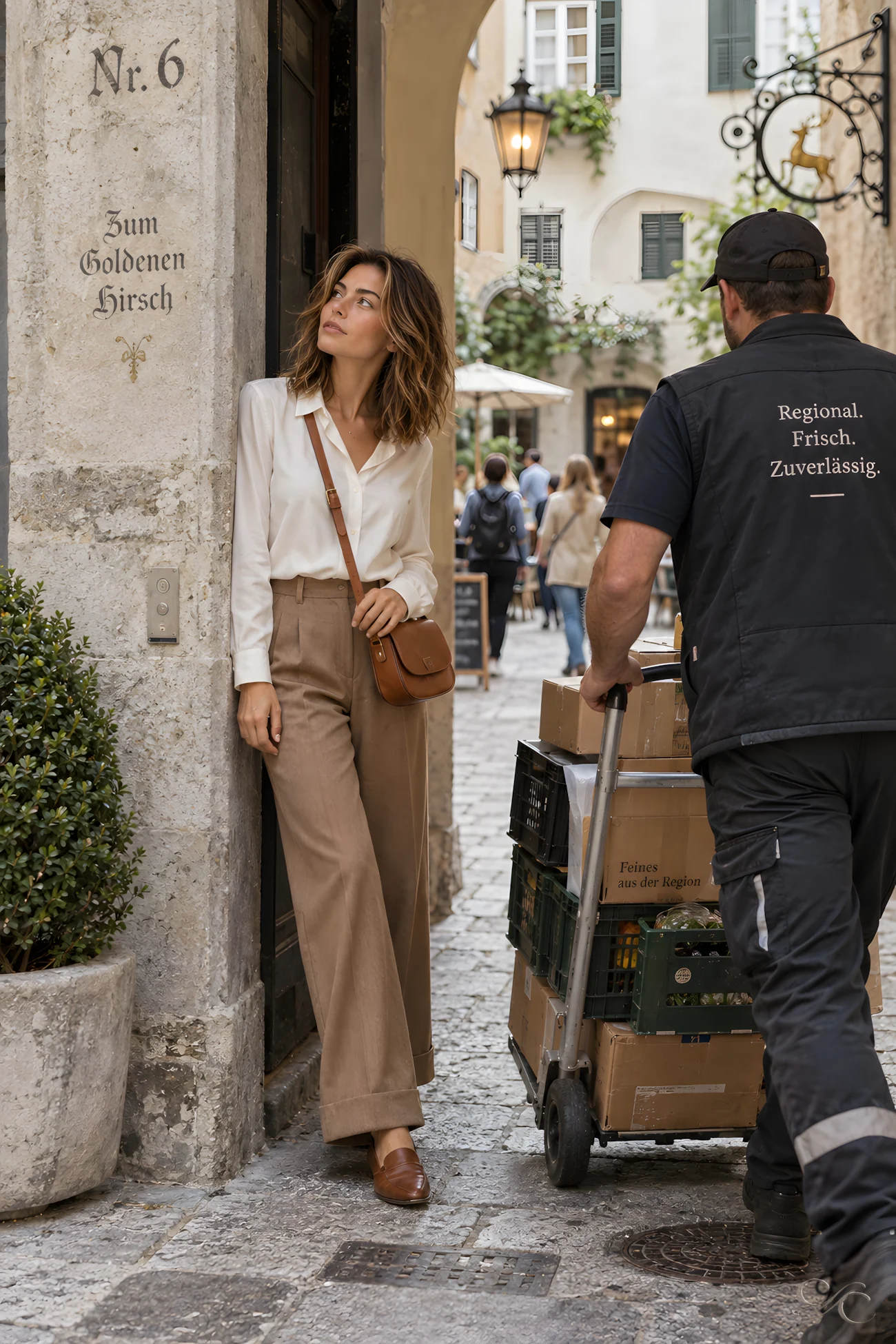
I stepped aside in a narrow Baroque street while a delivery handcart rattled over the worn stone and disappeared into a small courtyard. Shop signs projected above the passage, alongside faded address lettering from an older system. Before house numbers became standard, Salzburg buildings were often identified by names or trade signs, useful markers in lanes where several doors could share one passage. Deliveries still followed those tight routes beneath lettering left by earlier occupants.
First Clear View of the Mountains
On the road toward Wolfgangsee, the outskirts thinned into fields, and low foothills no longer screened the higher slopes. By St. Gilgenin in Austria’s Salzkammergut, tiled rooftops sat beneath a continuous mountain skyline. I checked the onward route, then paused to fill my bottle at the village fountain. St. Gilgen stands at the lake’s northwestern end, below the Zwölferhorn; the slopes remained

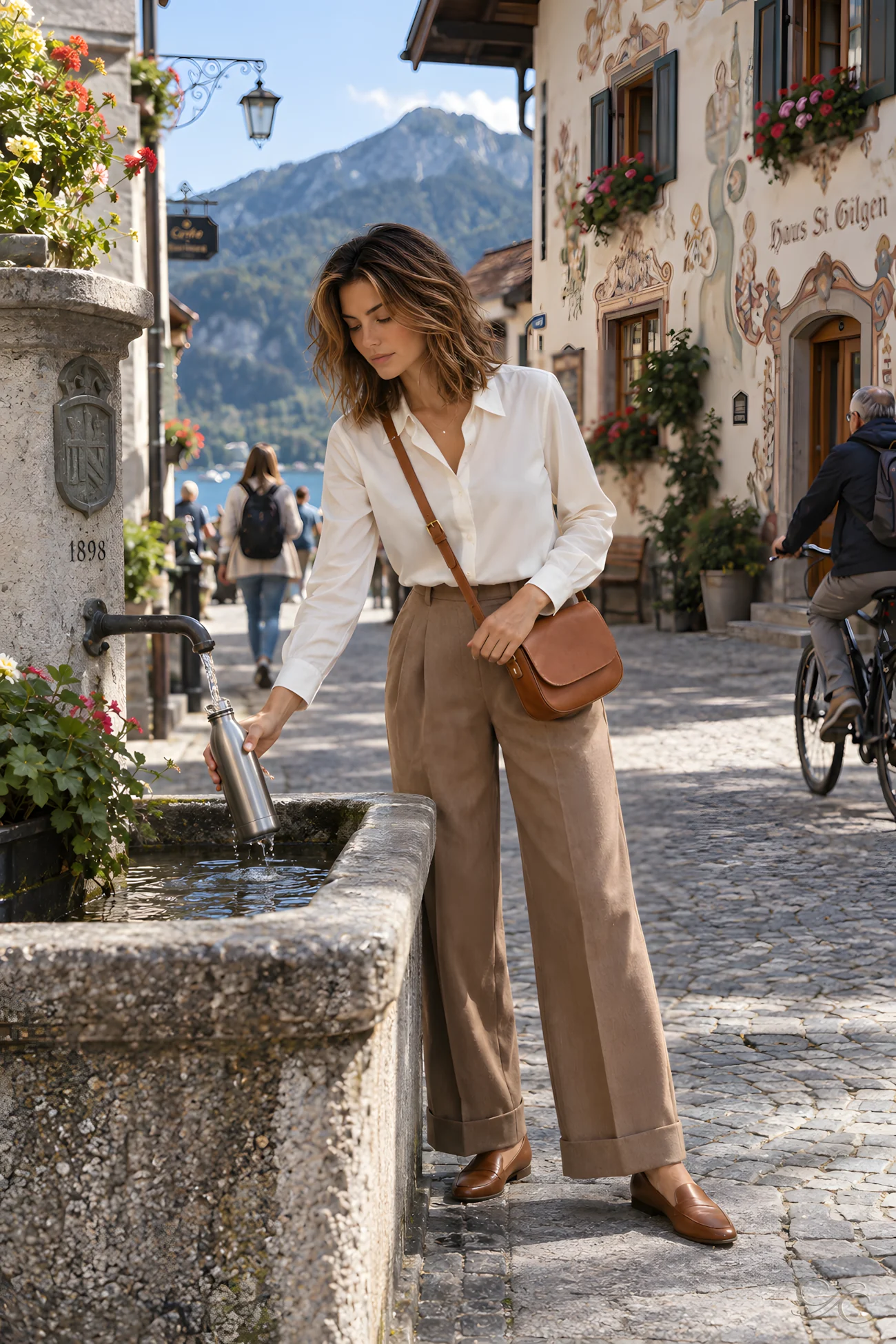
visible at the ends of streets lined with painted façades and timber-detailed houses.
Following the Shore of Wolfgangsee

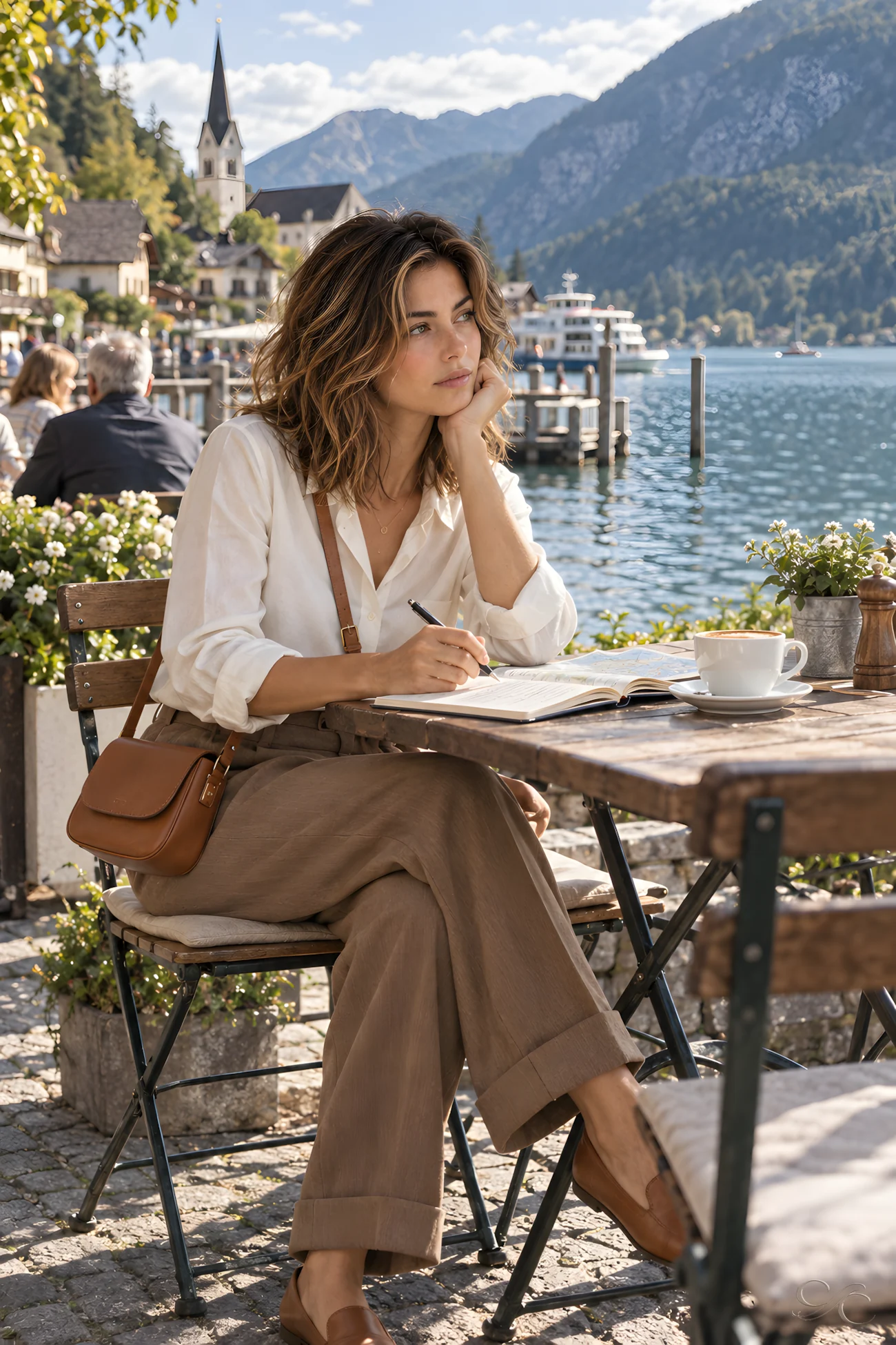
At St. Gilgen’s ferry landing, village traffic gave way to boats crossing Wolfgangsee and walkers following the shore. Passenger service on the lake dates to 1873 and still links St. Gilgen, Strobl and St. Wolfgang. I stayed near the water as the afternoon boats returned, their arrivals briefly gathering people at the landing before the shore quieted again. Instead of continuing toward Tyrol, I opened my journal at the water’s edge and recorded the day.
Packing for the Westward Drive
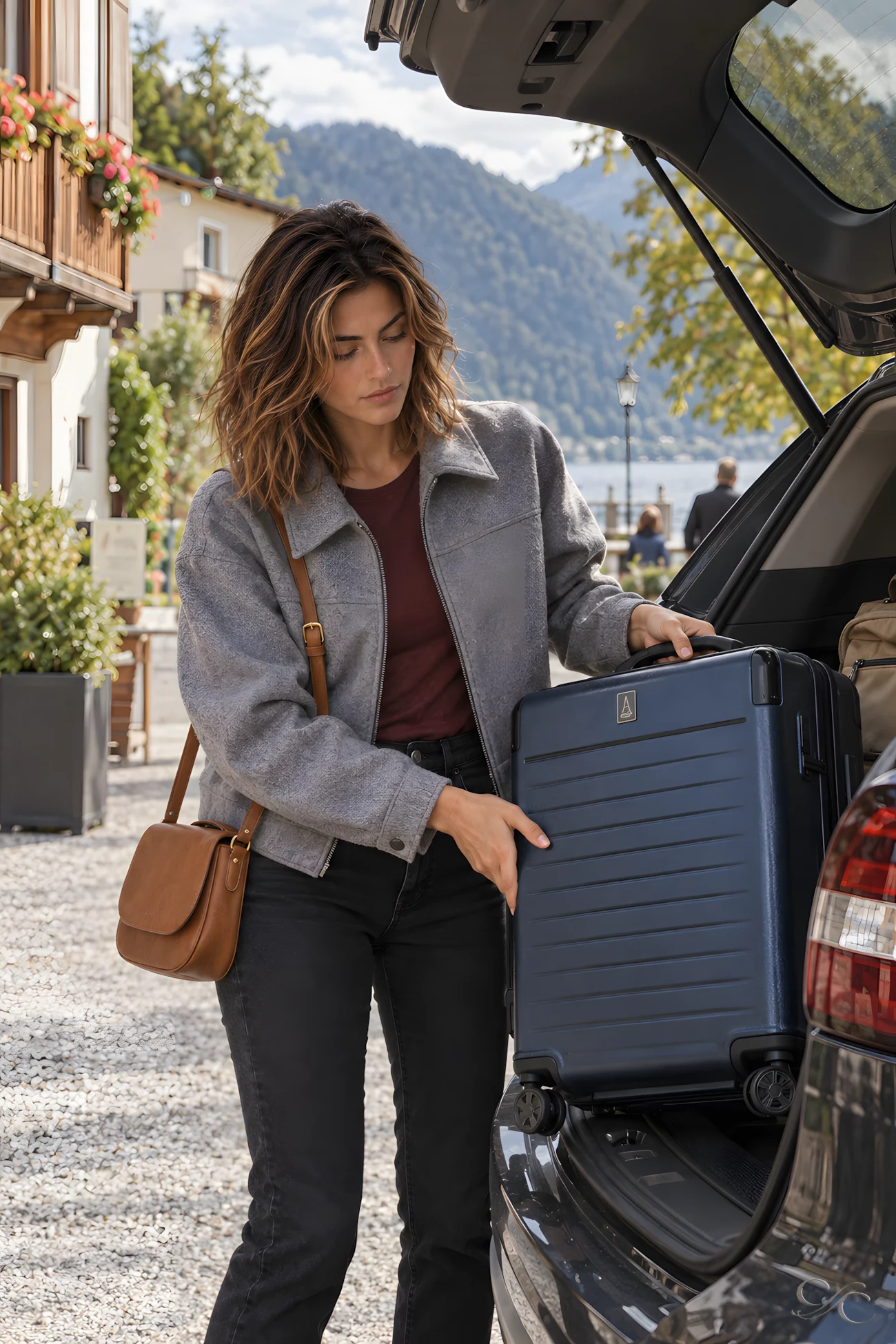
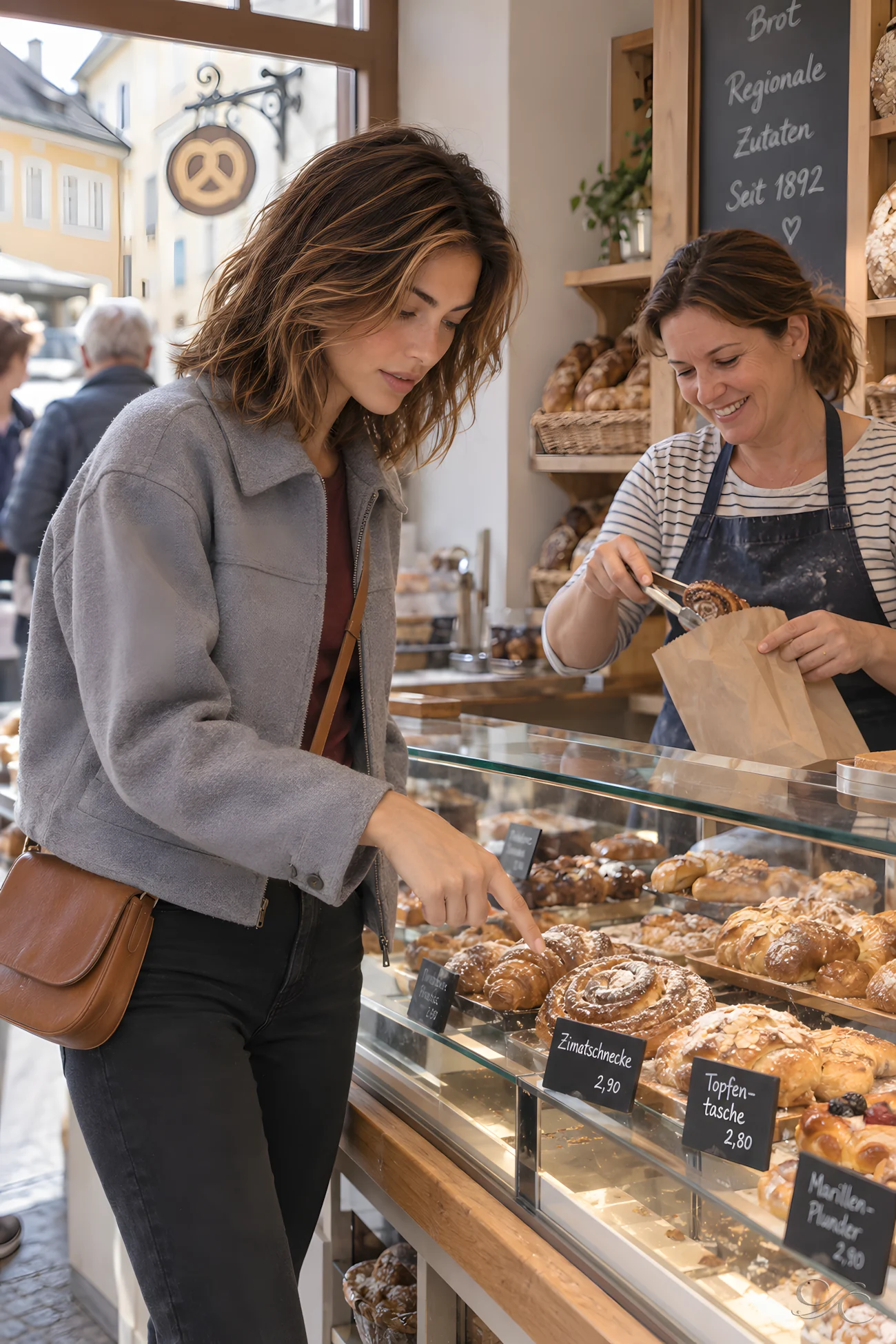
I packed the car beside the lake, checked the westward route and pulled away. The road passed through small towns, and a bakery offered a convenient place to stop. Alongside cakes and filled pastries, the counter held the daily bread and breakfast rolls bought during routine errands. I chose a pastry for the road, then continued west.
Mountains Beyond the Windscreen
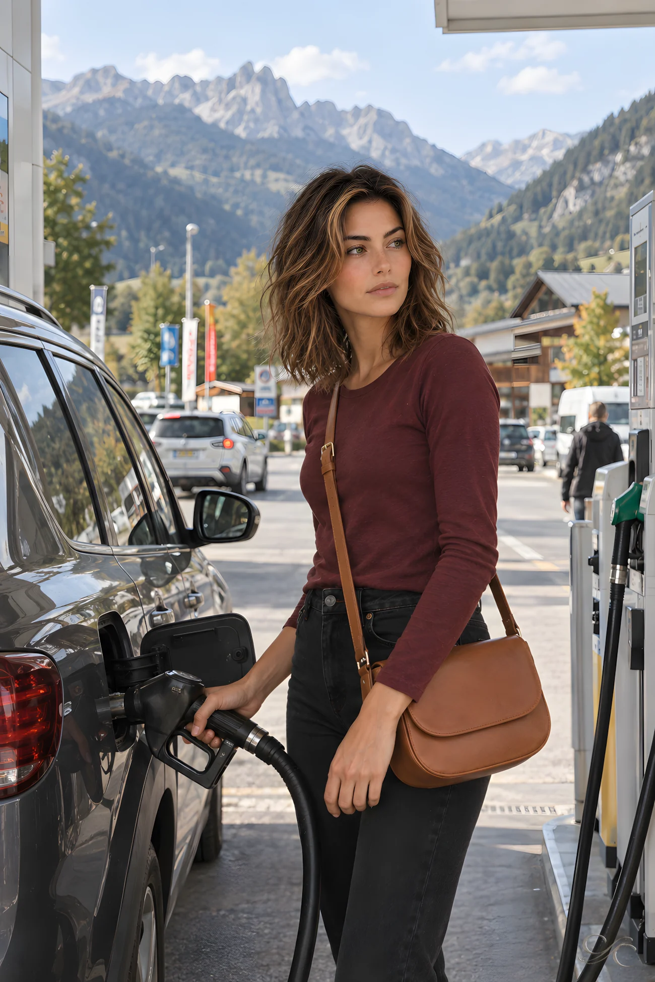
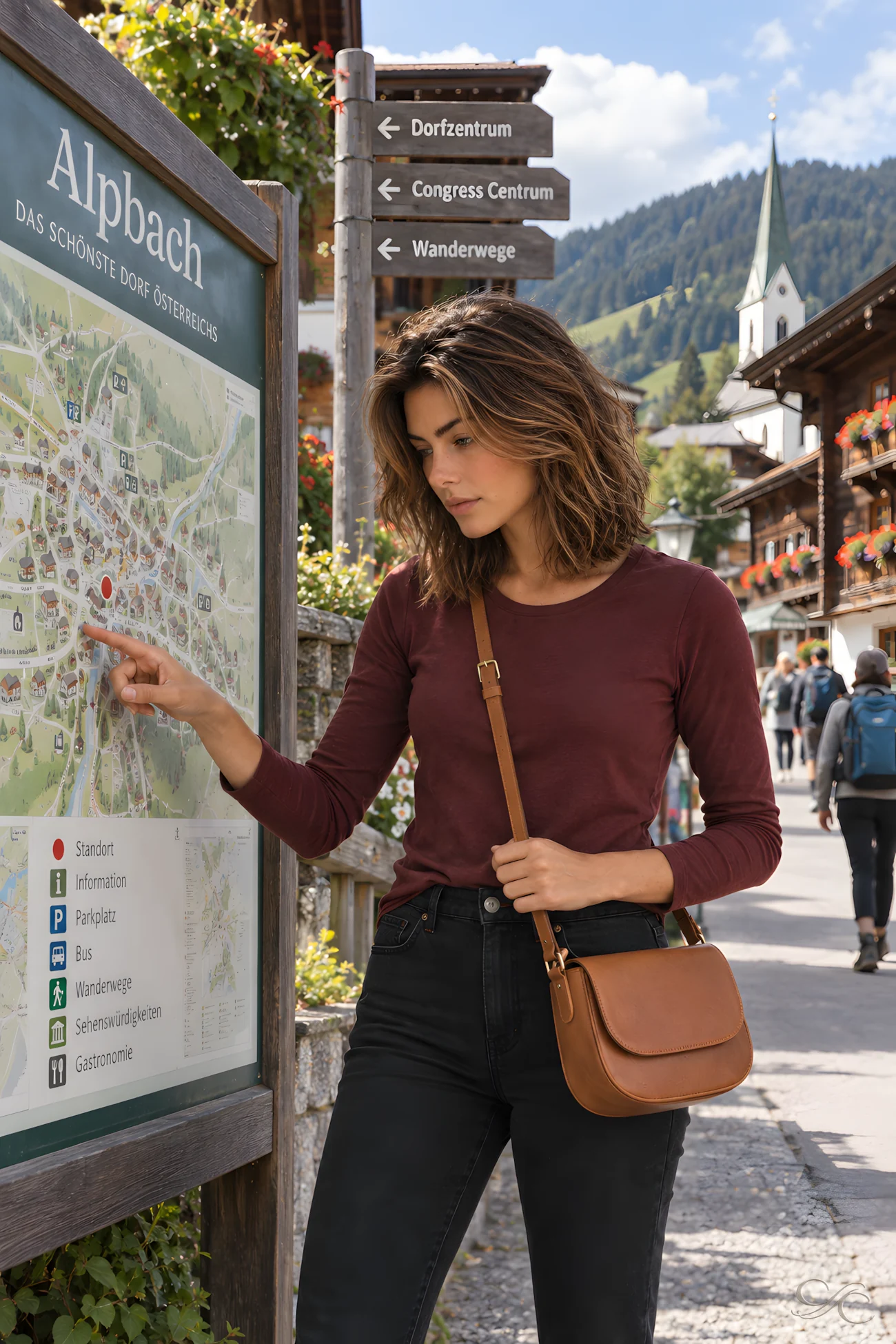
By midday, the rounded lake-country hills had opened into a broader valley, with steeper peaks filling more of the windscreen. At a roadside pause, pasture climbed toward the lower slopes. In Alpbach, I left the car and followed the sloping village streets on foot. Timber-fronted houses lined the route, their uniform appearance partly due to building regulations introduced in 1953 to preserve the village’s traditional architecture.
Making Room for a Farm Tractor
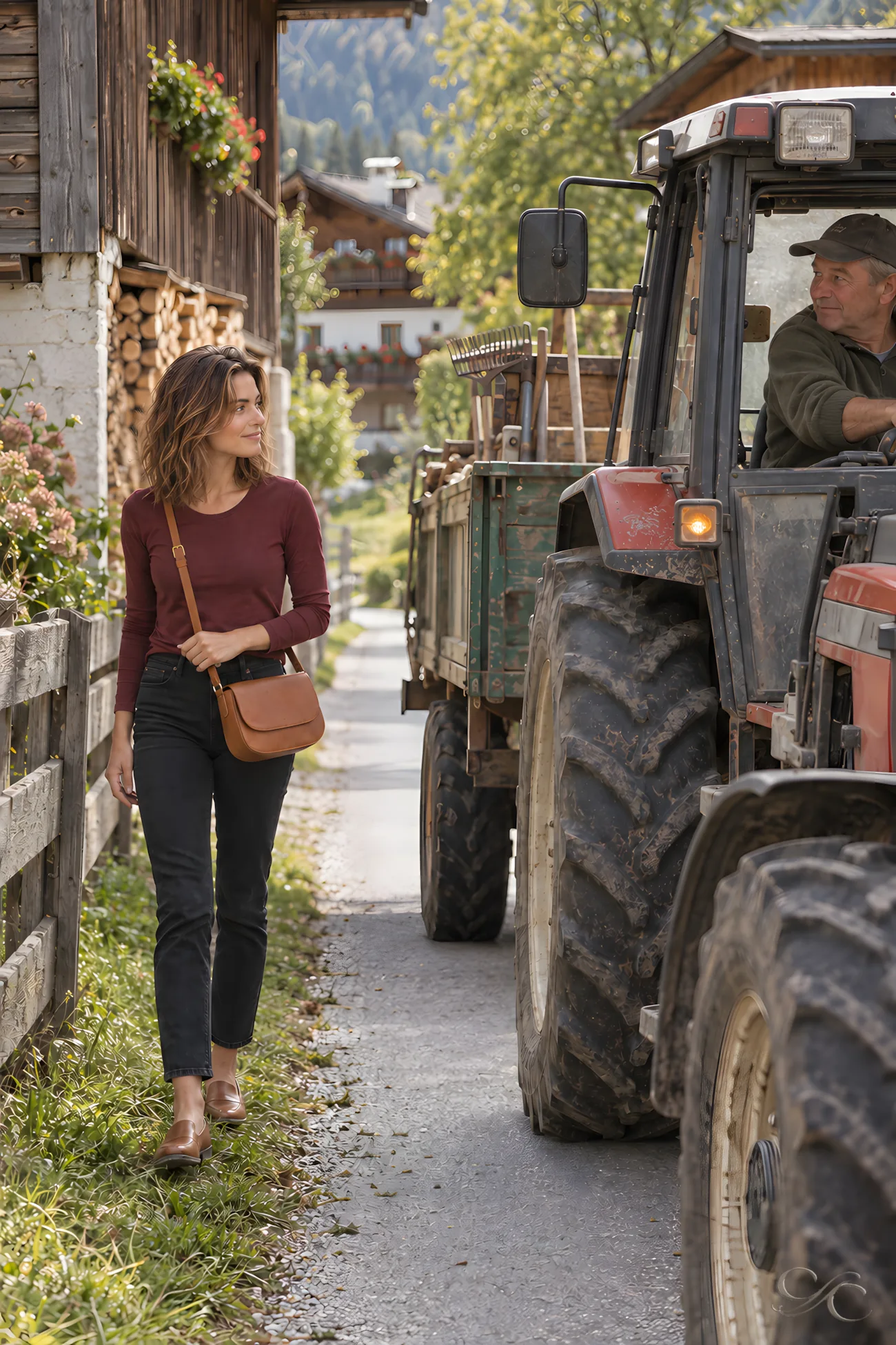
Beyond Alpbach’s central street, a narrow lane served as farm access as well as a walking route. When a tractor approached, I stepped onto the verge and let it pass. Across Tyrol, such lanes connect barns and farmhouses with pastures and hay meadows; walkers share them with local cars and agricultural machinery. Once the tractor had gone, I stepped back onto the lane and continued between the working fields.
Tyrolean Supper at Day’s End
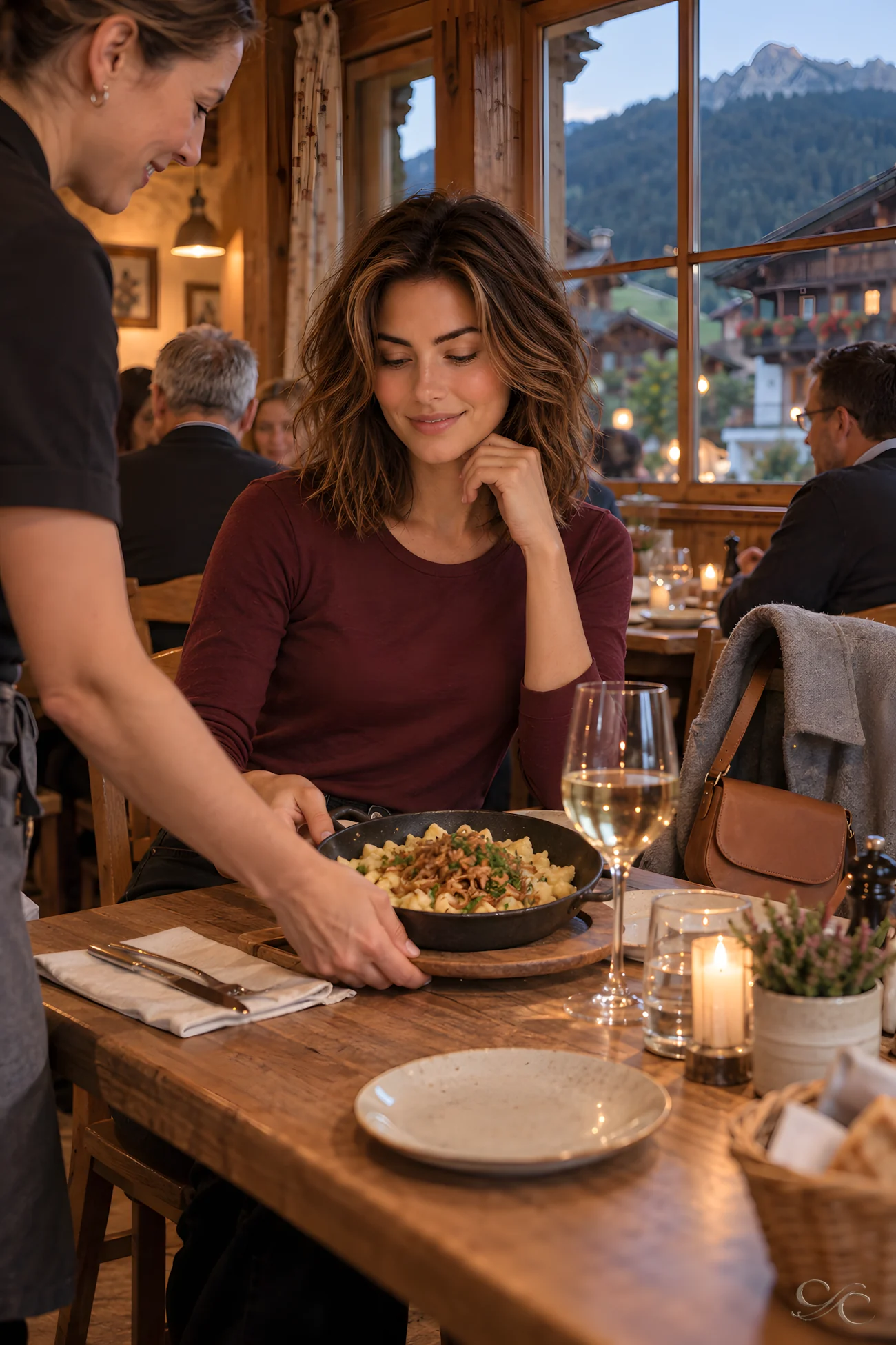
At a village inn, I folded my route notes and left tomorrow’s roads alone. The dining room was quiet after the farm lanes, and a hot Tyrolean supper replaced the day’s driving stops. In Tyrol, Stube traditionally meant the heated living room; in an inn, it often describes a compact, warm dining room. Beyond the windows, Alpbach’s farms and dark mountain slopes remained close. Inside, conversation stayed low, and I lingered over the meal.
Descending into the Inn Valley
Below Alpbach, the road dropped through tight bends, with each turn opening a wider view of the Inn Valley. Signs for Innsbruck replaced the smaller village directions. A steadier stream of valley traffic joined the local cars and farm vehicles. Fields spread across the broader floor, while Innsbruck appeared ahead between the mountains. The Inn Valley is one of Austria’s principal east–west Alpine corridors, carrying road and rail routes through otherwise steep Alpine terrain.

A Tyrolean Shop Discovery

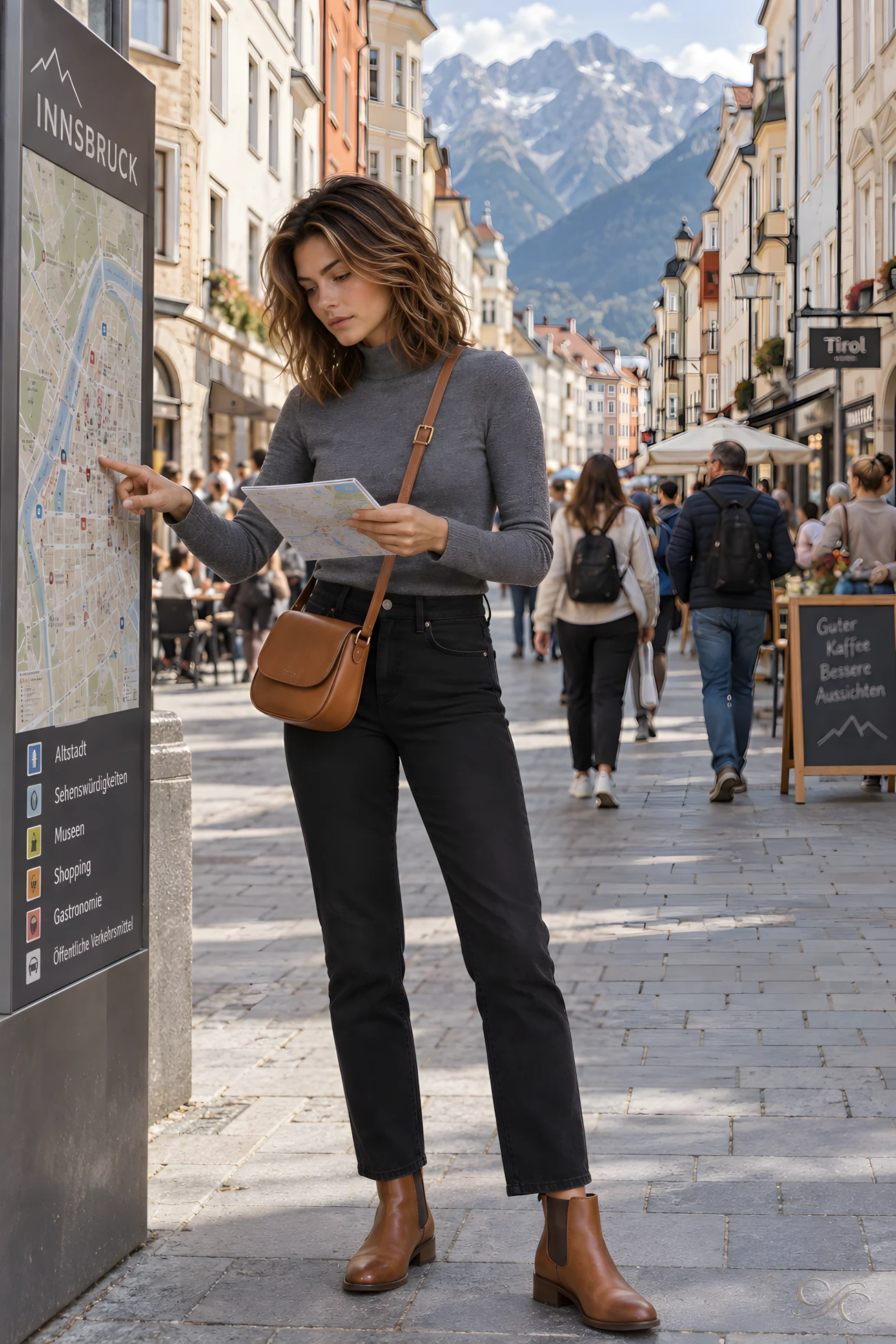
I followed the busy Old Town streets past ornate façades and arcades. In a specialty shop, shelves held Tyrolean preserves, honey and packaged foods. Granten, the local word for lingonberries, appeared on several jars; the tart preserve is traditionally served with game. I checked the labels, chose one locally sourced Tyrolean product and carried it back into the pedestrian traffic.
Riding Above the City
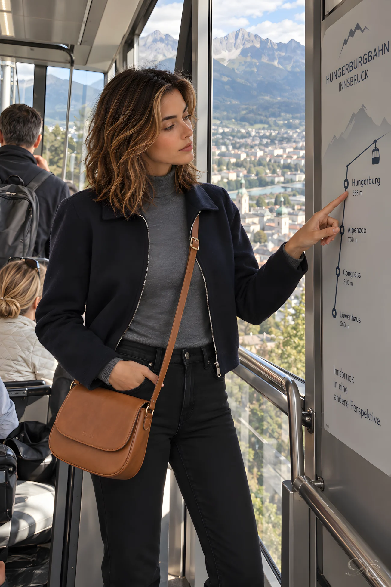

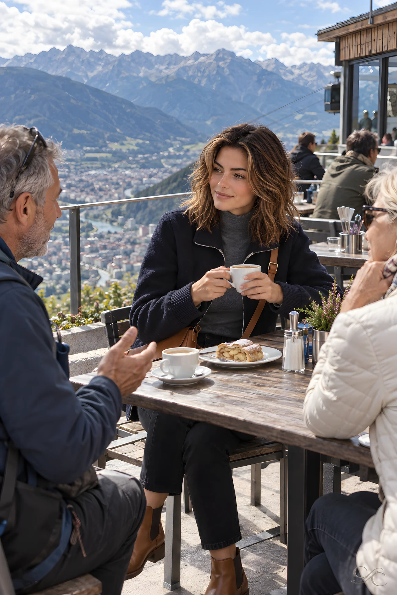
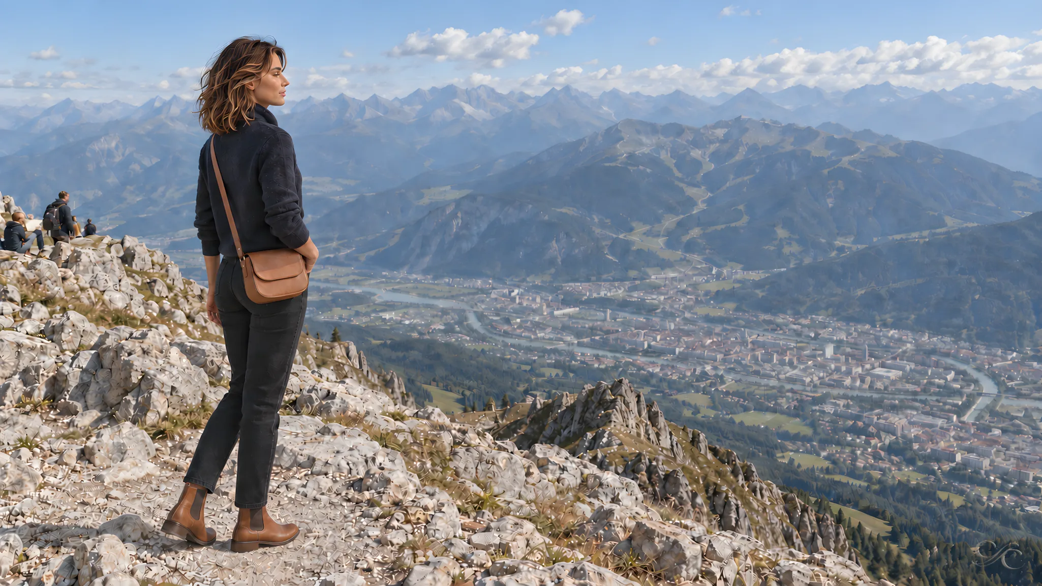
From central Innsbruck, the Hungerburgbahn carried me beyond the streets and onto wooded slopes. At Hungerburg, I changed to the cableway and continued above Seegrube to Hafelekar’s exposed, rocky terrain. Marked paths did not remove the need for care: the footing was rough, and high-alpine conditions could change quickly. On the descent, I paused at Seegrube for coffee and Apfelstrudel. The café’s shared table made conversation easy, with Innsbruck spread across the valley below.
Dinner Back at Street Level
Partway through dinner at an outdoor restaurant in central Innsbruck, I watched nearby tables settle into conversation as people crossed the street beyond them. A glass of Austrian white wine stood beside my plate. Tyrol is better known for mountains than vineyards; much of Austria’s white wine comes from eastern regions such as Lower Austria, far back along my route. Only a short while earlier, I had been above the city on the Nordkette. From the restaurant, the cableways and rock seemed distant.

Wines to Try
I noted the names that had been most useful to recognise around the Wachau and Lower Austria:
- Grüner Veltliner: Austria’s signature white; typically dry, fresh and citrus-led, often with a peppery note.
- Riesling: Particularly suited to the Wachau’s steep terraces; dry, aromatic and usually more mineral than sweet.
- Federspiel: Federspiel is a Vinea Wachau classification introduced in the 1980s for dry, medium-weight wines with no more than 12.5% alcohol.
- Smaragd: The Wachau’s fuller, more concentrated dry style, often worth serving with food.
- Neuburger: A less familiar local white, generally soft, nutty and rounded.
- Zweigelt: Zweigelt is Austria’s most widely planted red grape and commonly produces bright, cherry-fruited wines.
My Notes
Combining rail with a rental car worked well: the train handled the departure from Vienna, while driving allowed time for smaller villages, lakeside stops and the detour through Alpbach.
- Allow for weather. Rain slowed the Wachau drive and made Dürnstein’s castle path slippery. Clear intervals were worth using rather than following a rigid schedule.
- Keep a map alongside navigation. It helped me judge the short distances between Krems, Dürnstein, Spitz and Melk, and plan stops before entering narrow village streets.
- Do not rush Salzburg or Wolfgangsee. An evening and the following morning suited Salzburg; at St. Gilgen, extra time by the ferry landing was more useful than adding another stop.
- Expect working roads in Tyrol. Around Alpbach, narrow lanes served farms and tractors as well as walkers and local cars. The descent into the Inn Valley brought much heavier traffic.
- Treat the Nordkette as mountain terrain. The ascent from central Innsbruck was quick, but Hafelekar had rough footing and changeable conditions. Layers, firm shoes and time for the return journey mattered.
Camille’s Travel Wardrobe
Camille’s wardrobe changed with the journey, from a lightweight leather jacket and jeans in the rainy Wachau to merino layers and tailored trousers farther west. These are the pieces she wore, or the closest current versions from the brands we work with.
Wachau
Leather racer jacket · ivory knit · dark straight-leg jeans · cream sneakers · crossbody bag
Salzburg & Salzkammergut
Silk blouse · silk-wool trousers · leather loafers · crossbody bag
Tyrol & Innsbruck
Merino sweater · straight trousers · leather boots · crossbody bag
Travel Gear
Travelpro hardside spinner suitcase: Camille uses this throughout the journey, from the rail-to-car transfer at St. Pölten through the hotel arrivals.
The Journey Continues
Innsbruck marked the end of my five days across Austria, but not the end of the westward route. From Tyrol, I would continue through the Arlberg toward Vorarlberg and the Rhine. The vineyards and Danube terraces of the Wachau were now behind me; ahead, another river would shape the next stage of the journey.
If you’re planning a trip to Austria, Prague, Slovenia, or other European destinations, 💬 chat with me for ideas on timing, wine, where to stay, and how to shape the journey naturally.
À bientôt,
Camille ✨